Offline Map Data Generator
Available for Mobile (iOS, Android) and Windows
Download nearly any online map data for offline or on-premises use
MBTILES Edition
Tile Package (VTPK and TPKX) Edition
Advanced High-Performance solution for Downloading Map Data and Tiles
Basemaps – (like OSM Vector Tiles, Raster Tile Basemaps like Stamen Terrain and Thunderforest Outdoors)
Overlays – (like OSM points of interest, NGA GeoNames/USGS GNIS)
Terrain-Elevation
(available in common ready-to-go pre-staged areas by Regions, Countries, US States, and Canadian Provinces) as well as custom Area of Interest/Operation
Download from nearly any Mapping Service URL (we have some pre-configured URLs)
Users define an area of interest (AOI), select the level of detail Starting and Ending Map Zoom levels, and Enter the URL for any mapping service ( OGC WMS, OGC WMTS, or ESRI MapServer and ESRI ImageServer.)

Features in the App
Pre-Staged Ready Data
Pre-Staged Ready Data by Country, Region, US States, Canadian Provinces
OSM Vector Tiles, Contour Lines, Hillshade, Shaded Relief, Reference Links and Labels, Satellite Imagery
TMG DEM Downloader API
DTED dt1, dt2, dt3 or HGT 1 degree tiles (optional products contour lines vector tiles MBtiles, hillshade raster tiles MBtiles, hypsography Geonames points MBtiles)
Download Dynamic and Cached Mapping Services & Tile Layers
Select a pre-defined common Map or Enter the URL of an internet-accessible OGC or ESRI Mapping Service.
Download Online Mapping URLs
Vector Tiles, Raster Tiles, Elevation/Terrain Tiles, and as vector data GeoJSON and KMZ
Downloading from ESRI MapServer and ImageServer
Coming Soon – OGC WMS and WMTS and WFS Downloading
Ready to go Data in our Data Distribution Server
Includes Basemaps osm vector tiles, hillshade raster tiles, contour line vector tiles, low res satellite raster tiles, reference lines and reference labels raster tiles, for some regions and areas high res satellite raster tiles, MapZen Terrarium RGB encoded Elevation Terrain tiles PNG
Available in the following formats:
-
MBTILES offline SQlite databases -regular edition
-
ESRI TPKX and VTPK – tile package edition
of Raster Tiles, Vector Tiles, and Elevation Tiles for use in the app when the users is disconnected from WiFi and 4G/5G Connection.
Available by US States, US Regions, Canadian Provinces, and Countries Users can download unlimited datasets for each folder and unlimited Countries/Regions/States.
- Open Street Map Vector Tiles
- Contour Lines Vector Tiles
- Hillshade Raster Tiles
- Low Resolution Satellite Imagery Raster Tiles
- Stamen Terrain Background Raster Tiles
- Stamen Reference Lines Raster Tiles
- Stamen Reference Labels Raster Tiles
- Thunderforest Outdoors Basemap Raster Tiles
Perfect solution for TAK users struggling to get data for ATAK, iTAK, WINTAK
Perfect solution for ESRI ArcGIS Mission Responder Users wanting to get data for large geograhic areas and to support agencies in another jurisdiction
Perfect solution for getting data for Air Gapped on-Premises (within Firewall) Environments for local basemaps and overlays
Map Tile & Vector Data Downloader
Offline Map Data Generate App Download Online Mapping Services Dynamic and Cached
- Download XYZ Tile Servers (png, jpg,webp, other) -creates MBTILES
- Download Vector Tiles (pbf/mvt) – creates MBTILES or VTPK
- Download Dynamic and Cached Mapping Services (ESRI MapServer, ImagerServer) -creates MBTILES or TPKX
- Download ESRI FeatureServer and MapServer as GeoJSON – can convert to KML in the app or other formats
-
DTED dt1, dt2, dt3 1degree files as zip archive
-
HGT 1 degree tiles as zip archive
-
optional products:
-
contour lines vector tiles MBtiles,
-
hillshade raster tiles MBtiles
-
hypsography Geonames points MBTiles
- DTED data is meant for ATAK and WINTAK apps but can be used in QGIS Desktop, Global Mapper as well
-
-
Future versions will include support for other formats such as: TPKX Elevation for ESRI Apps and MBTILES/GPKG with Quantized Mesh Terrain Tiles or MapBox Terrain-RGB PNG encoded Terrain-Elevation Tiles
ATAK integration
accepts tile.xml as a configuration of the URL to download
Preparing Data for TAK apps (WinTAK, ATAK, ITAK, ARTAK, MCH, and others)
Download from TMG Tile Server and Geo Data Server (Edge Server) & GISCMS back-end (data_distribution and file_list JSON endpoints)
Download from TMG Tile Server and Geo Data Server (Edge Server) & GISCMS back-end (data_distribution and filelist JSON endpoints)
Custom Area of Interest Downloading
This in-app purchase unlocks Tech Maven Geospatial’s GeoRequest Area of Interest API.
Where users can submit an area of interest request and select a dataset to download from our curated list of about 50 datasets.
Then once users download this data they can use it offline/disconnected.
Currently this is limited to MBTILES and GPKG
with Tile Converter API (in Tile Package Edition) supports Converting MBTILES for ESRI Tile Packages (TPKX and VTPK)
3D Map/3D Terrain and 2.5D Buildings interest
Worldwide Online and Offline for an Area of interest vector Tile Basemaps from MapBox and OSM Vector Tiles change style map Rotates and Labels are correct and support 2.5D Buildings
Topo/Terrain Style with Contour lines and Hillshade
Hybrid Satellite from ESRI, HERE Maps and MapBox
In-app Vector Data Converter
Converts GIS Vector Data to optimized formats (Build MBTILES Vector Tiles, Build GPKG Vector Features or build GeoJSON or Build KML) – Convert an ESRI FileGDB, ESRI PersonalGDB, ESRI Shapefile, MapInfo, GPX, CSV and others
Live Event Driven Data Feeds
ESRI FeatureServer and Network Link KML Downloader Module – downloads the data at a set frequency and converts to GeoJSON (can be converted in-app to KML for ATAK or iTAK)
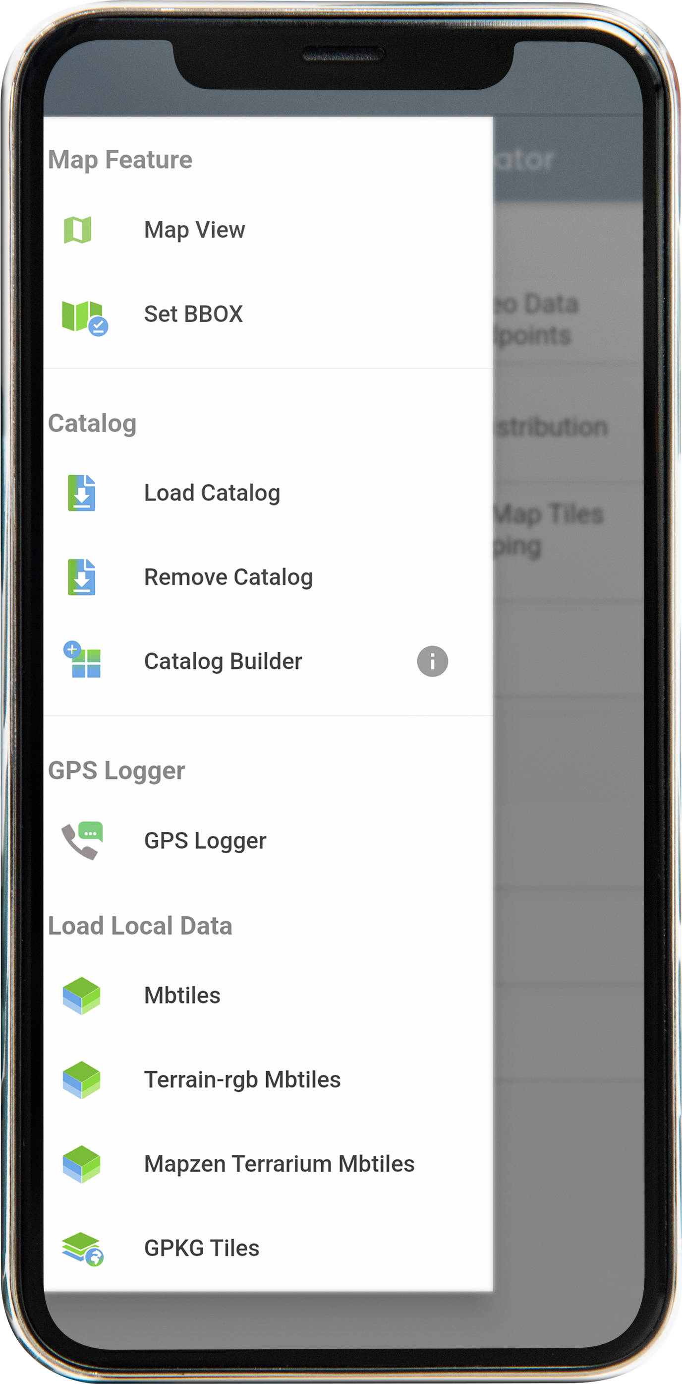
Main Screen
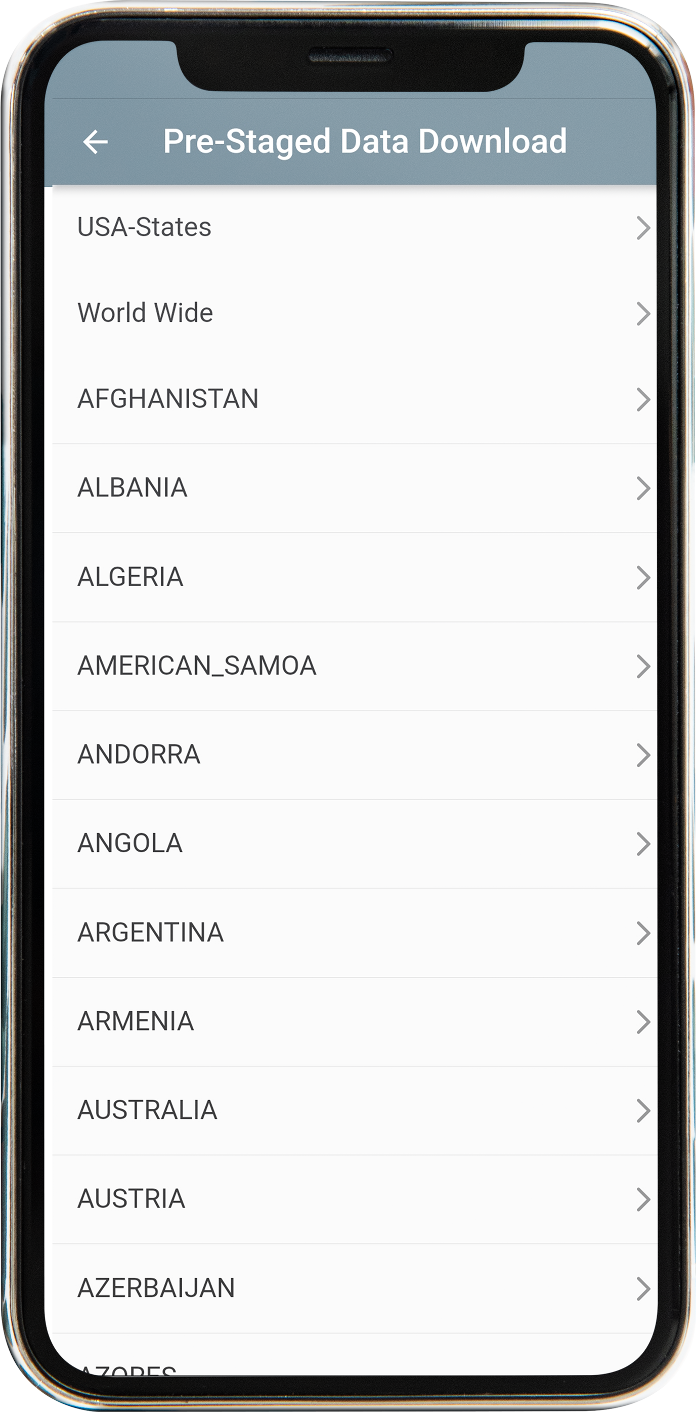
Pre Stage Data Download
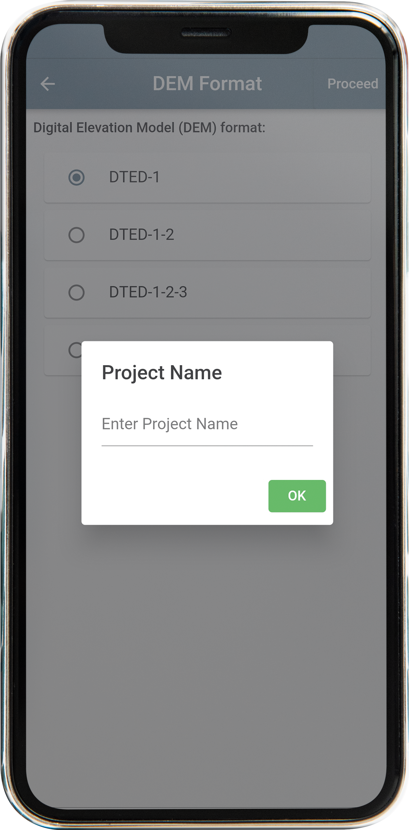
Specify Name of your custom area of interest/operation
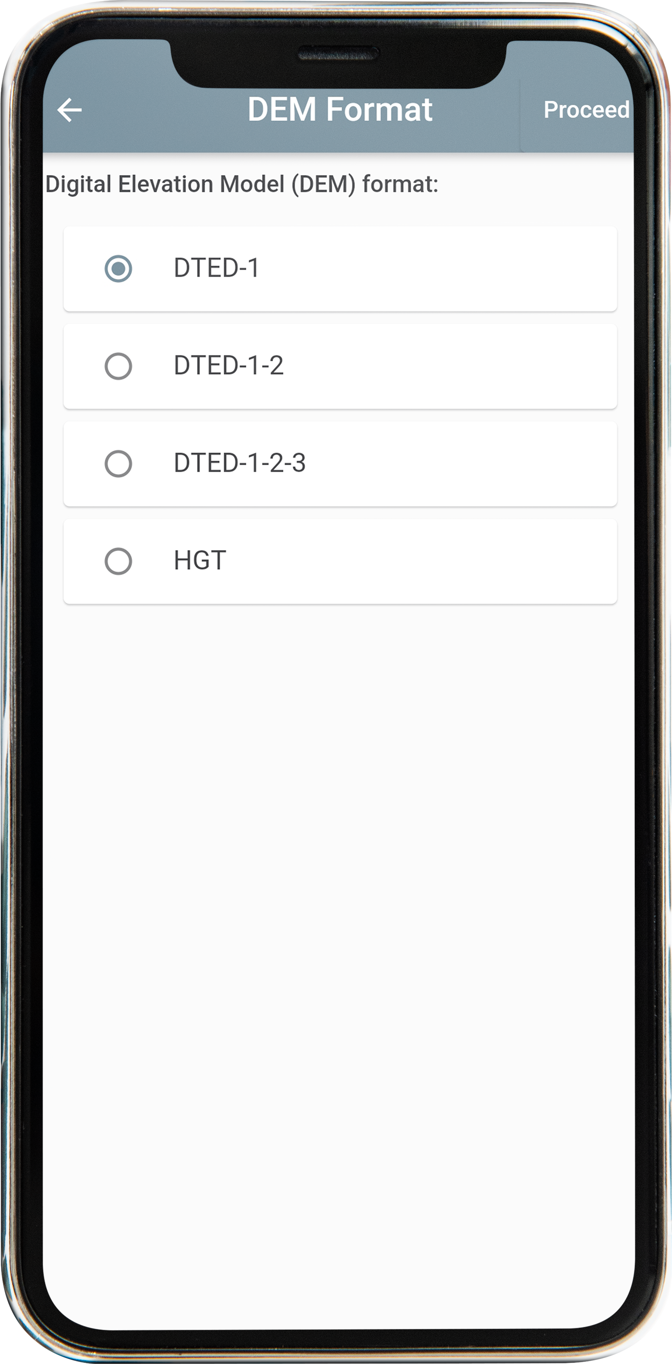
Select a DEM Format
Other Capabilities:
-
Download from Dynamic Mapping Services (WFS, MapServer, FeatureServer) as GeoJSON and use in-app converter or vector conversion API to have other formats.
-
Download from Tech Maven Geospatial’s Tile Server, GeoData Server, and 3D Scene Server (Data_Distribution, FileList) Download the data you have loaded in these apps (as well as backend for TAK SCOUT and Incident Mapper and Wildland Fire Mapper)
-
Load a Tile.XML ATAK/WINTAK configuration file for raster tiles
-
Mobile – pre-configured URLs
-
Windows – pre-configured URLs – user provided & TMG Provide
Geospatial Data Services
Contact us for custom data services
We offer advanced geoprocessing, map tiling and geospatial analysis and terrain-elevation analysis and derivative data products
Submit Custom Conversion Jobs
our team of Geospatial data engineers are ready to take on your data challenge
